Running a cloud project
This guide takes a coordinator from nothing to a running project on Collect Earth Cloud: the survey on the server, the plots given out, the team invited and working, the quality checked and the data downloaded. The interpreters keep working in the Collect Earth desktop program; every plot they save reaches the dashboard by itself.
Who does what
| Role | What they do | What they see |
|---|---|---|
| Coordinator | Sets up the project, invites people, gives out plots, decides when answers differ, downloads the data. Can also collect the plots they give themselves | Everything: every tab, names, quality per person, time spent per plot |
| Reviewer | Collects plots and helps check the quality | Progress, Map, Quality and Training, plus My work and My quality. No figures per person. |
| Collector | Assesses plots in Collect Earth | Their own work only: My work and My quality |
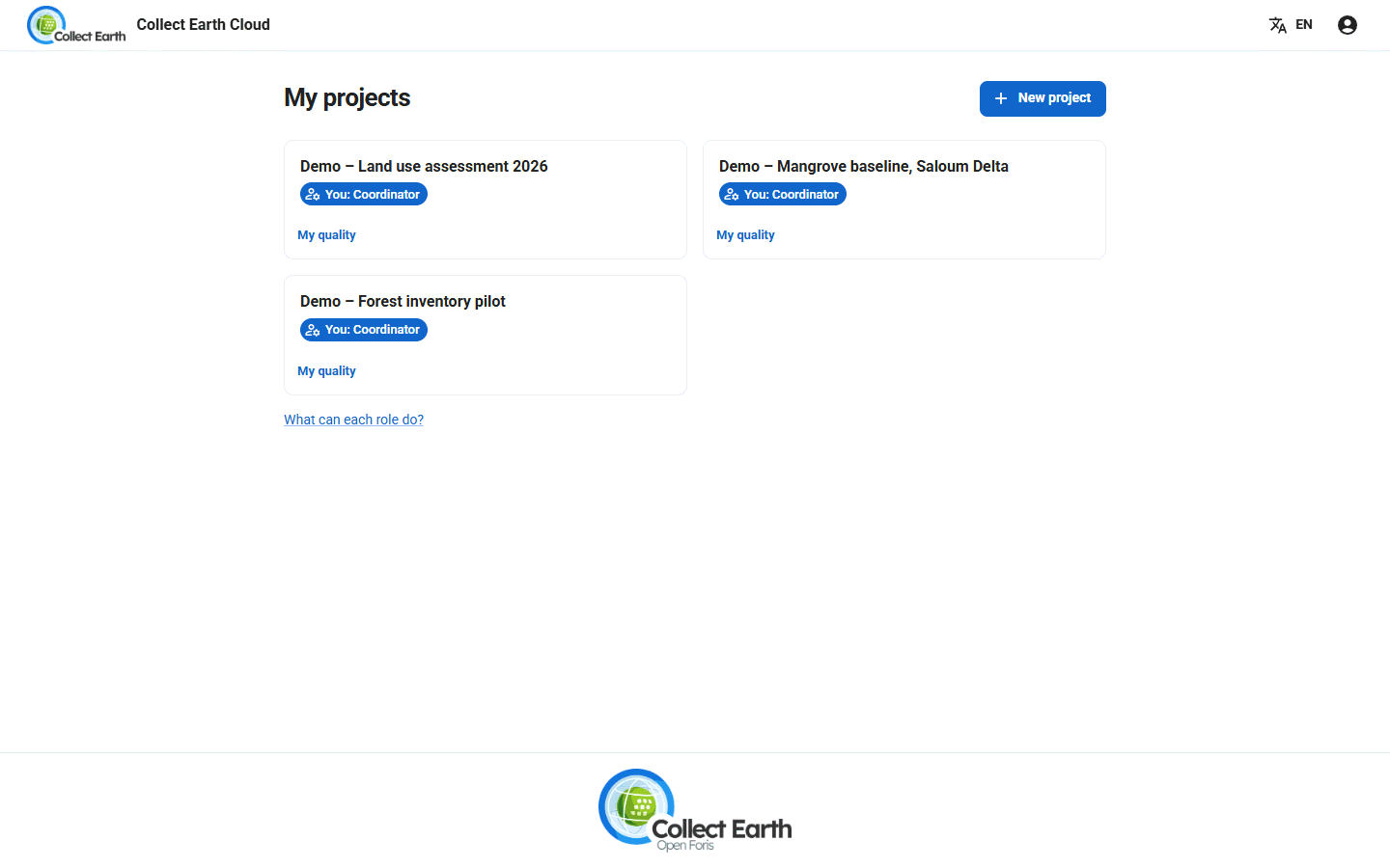
A project can have several coordinators. Every project shows your role in it (You: Coordinator), and What can each role do? lists, row by row, what each role may do and see.
Your account and a new project
- Open cloud.collectearth.org, the free server run by FAO, and Log in. On this server only the administrators create projects: ask FAO to create yours, or to let your account create projects. On your own server, its administrator decides Who can create projects.
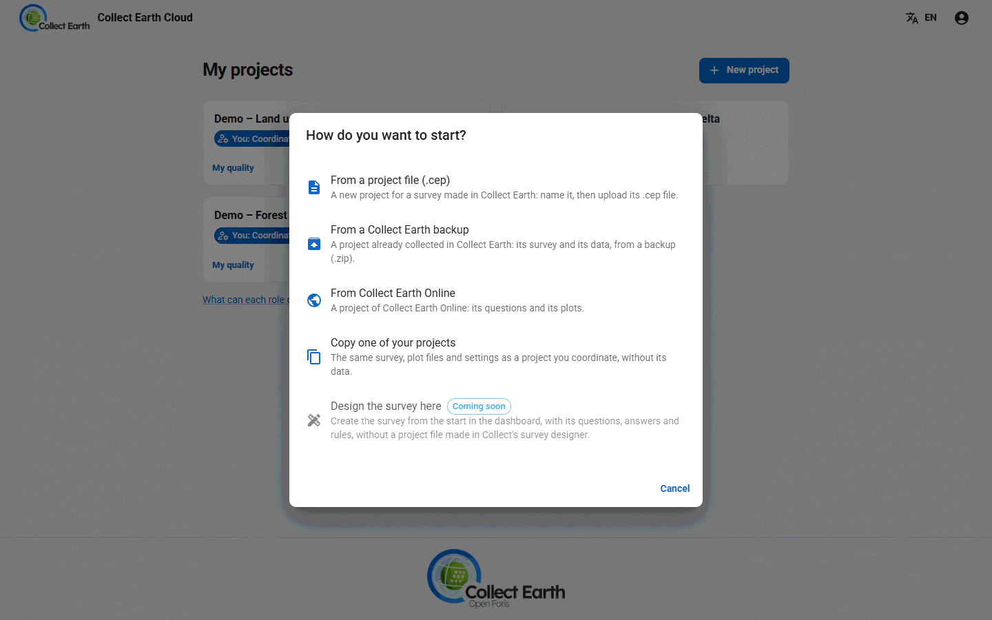
- With project creation allowed, press New project on My projects and choose how to start: From a project file (.cep) (type the project's name, then upload the file), From a Collect Earth backup, From Collect Earth Online (see below), or Copy one of your projects. Design the survey here, to write the survey in the dashboard itself, is coming soon.
- To start from work already done, choose From a Collect Earth backup: it takes Collect Earth's compressed XML export, or an Open Foris Collect backup, with the survey and the plots already assessed. Those plots go in a plot file of their own, ending in
_done.csv; leave it out when you give out the plots. - The project opens on Setup, with a Getting started checklist: upload the project file, add plot files, invite people, choose who collects each plot file, follow the progress.
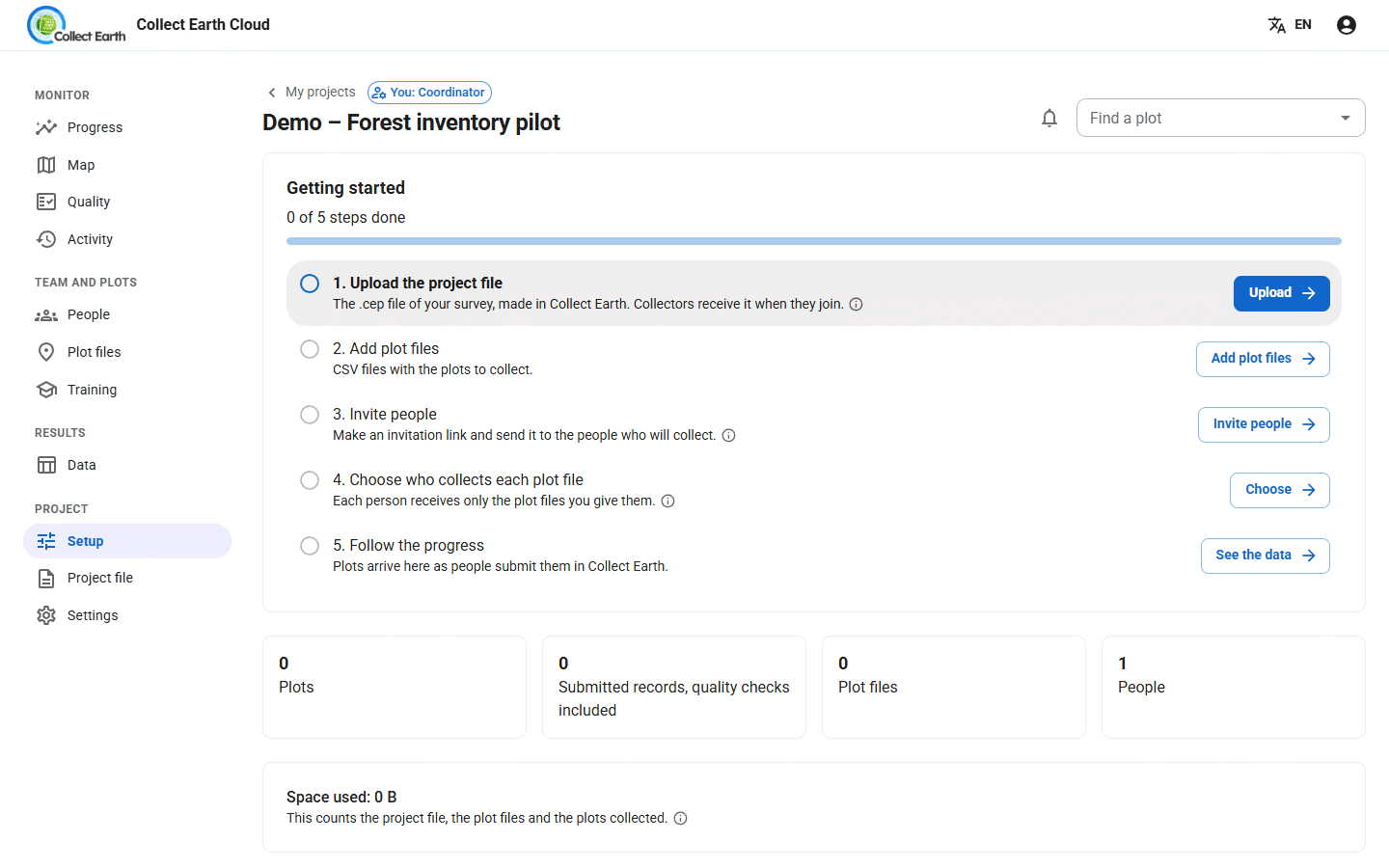
On a wide screen the tabs sit in a sidebar, grouped as Monitor, Team and plots, Results and Project.
The project file
The project file (.cep) holds the survey: the questions, the form and the project's settings. It is the same file Collect Earth opens on a computer. Design it in the Open Foris Collect survey designer and export it as a Collect Earth project.
- Open the Project file tab and drag the
.ceponto it, or press Choose the .cep file. - If the file carries plot grids, choose Merge into one plot file or add them as separate files.
- To change the survey later, press Choose a new version. People who join from now on get the new version; people already in keep the old one. For each of them, open their page in People and press Make a link for the new project file; they paste it in Collect Earth with File › Join cloud project....
The plot files
A plot file is a CSV with one row per plot: the plot id, the latitude and the longitude, then any extra columns the survey expects. On the Plot files tab, drag one or more CSV files in. They appear under Files uploaded.
No plot file yet? Design the plots makes one for you: draw plots At random, On a grid or At random within strata in an area, or take them from SIGRID, the global systematic grid, by country, province or district. Designing the sample explains these, and the Grid Generator on Google Earth Engine, which adds elevation, climate, soil and more to each plot.
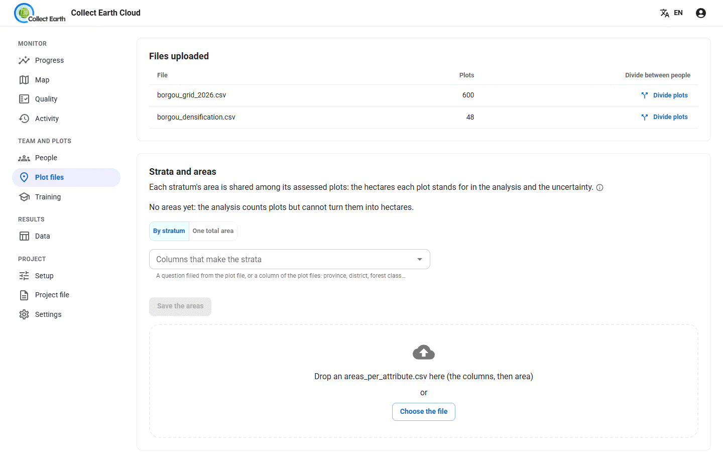
To turn plots into hectares, give the areas under Strata and areas: choose the question or the plot-file columns that make the strata (a province, a forest class…) and type each stratum's area, give One total area, or drop an areas_per_attribute.csv. The analysis, the IPCC uncertainty and the downloads then share each stratum's area among its assessed plots.
Inviting people
- On the People tab, under Invite people, choose how they join: Collector, Reviewer or Coordinator.
- Choose How many people can use it and how long The link works for. One link for many people works well for a training room.
- Press Make the invitation link and copy it. It is shown only once. Send it by email or chat.
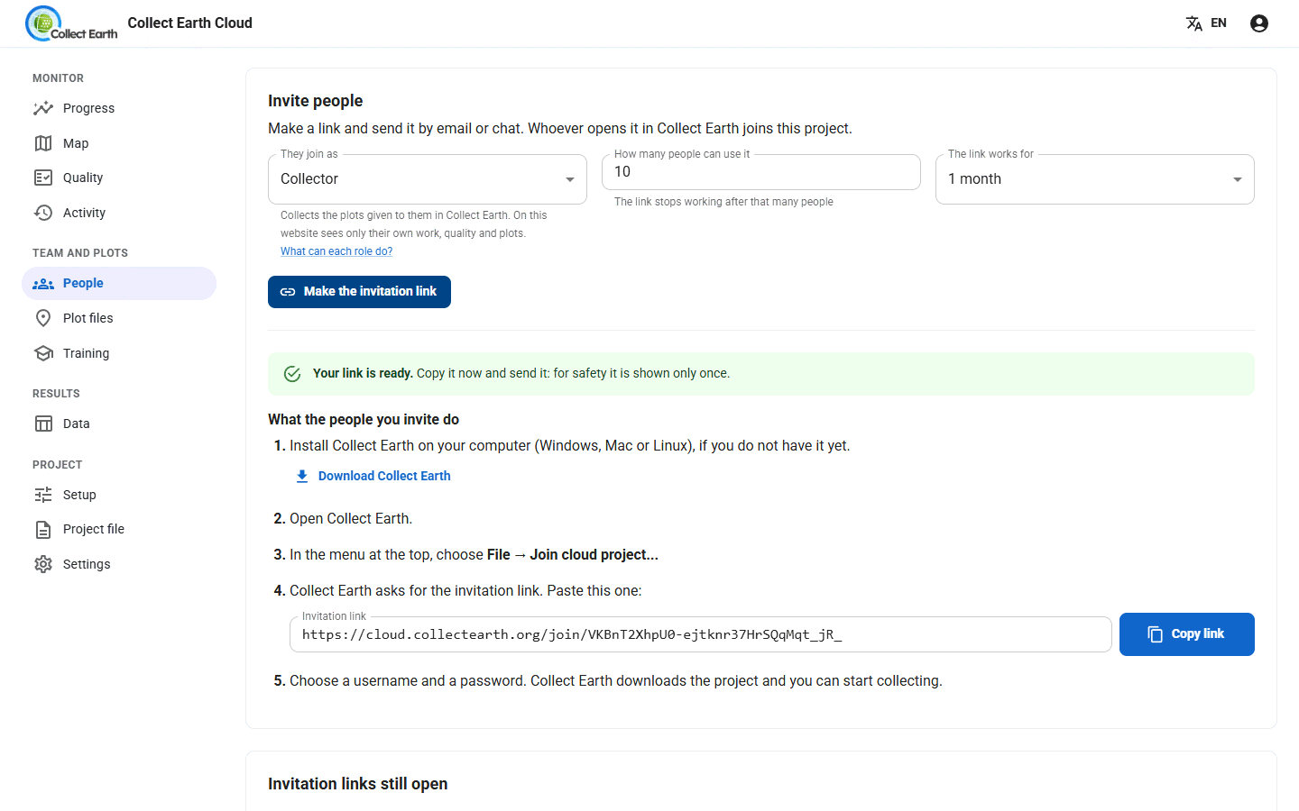
The person who opens the link sees how to join: install Collect Earth, join the project from its menu, paste the link, and choose a username and password. Collect Earth then downloads the project by itself. See joining a cloud project in the interpreters' guide.
Open links are listed under Invitation links still open; Stop this link closes one. Under People in this project you can change someone's role, remove them, or leave them out of the results.
Giving out the plots
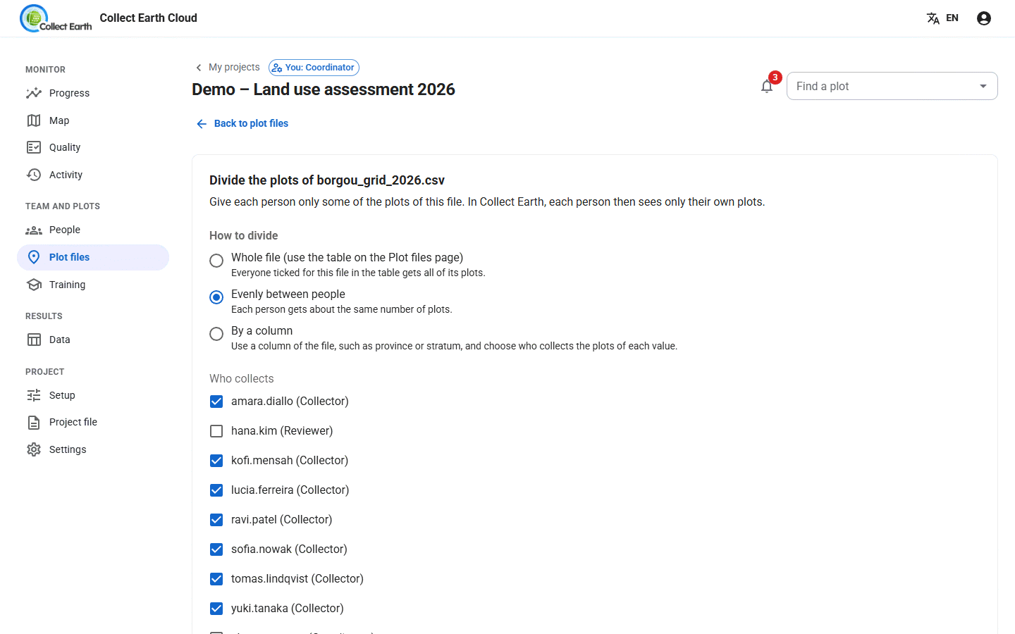
Under Who collects each file, tick the people for each file and press Save to give a whole file to them. You can tick yourself too: a coordinator collects the plots they give themselves. To share a file out, press Divide plots:
- Evenly between people, or By a column such as a province or a stratum, giving each value to one person in turn, or each person a share in percent.
- Which plots go together: In the order of the file, Mix them, or Keep plots that are close on the map together.
- Quality check: also give some plots to a second person, to compare their answers. Neither knows which plots are shared.
Press Preview to see the result, then Apply.
Collect Earth is not told about new plots. Collectors get their new list the next time they open Settings › Project in Collect Earth, or press Refresh assignments there, and then Apply. Tell them when you give out or move plots.
When someone leaves or falls behind, move their plots; what they submitted always stays with them:
- Move unfinished plots to…, on the plot file's page, hands all of a person's remaining plots to someone else.
- Move plots…, on the People tab under Who finishes when, gives some of a person's plots, or all of them, in one file to someone else.
- Share again what is left, on the plot file's page, shares the plots not submitted yet again between the people you tick: Equally, By percentage, or By pace so that everyone finishes around the same day. Untick someone to give all their unfinished plots to the others. A preview shows the moves before you apply them.
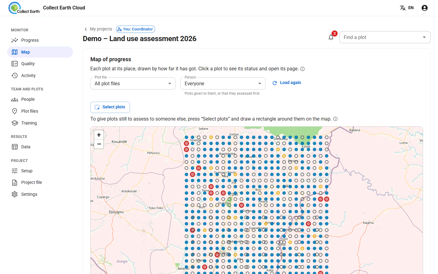
- Select plots, on the Map, draws a rectangle around plots still to assess and gives them to one person, saying which plots cannot move and why.
Following the work
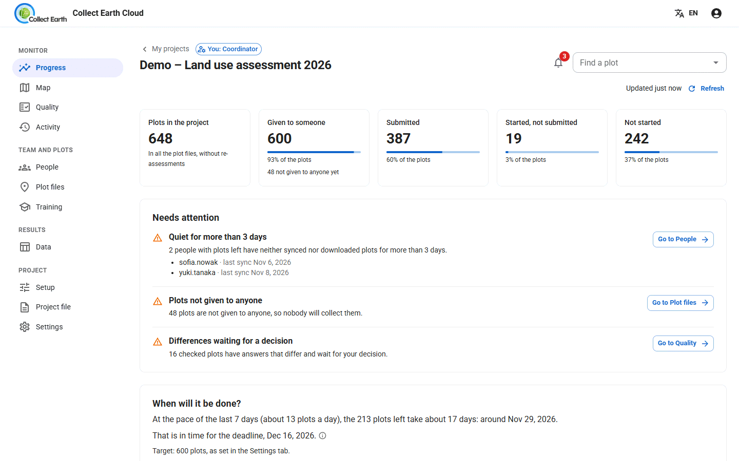
Progress shows how many plots are submitted, day by day, who Needs attention, and When will it be done?: at the pace of the last 7 days, against your deadline.
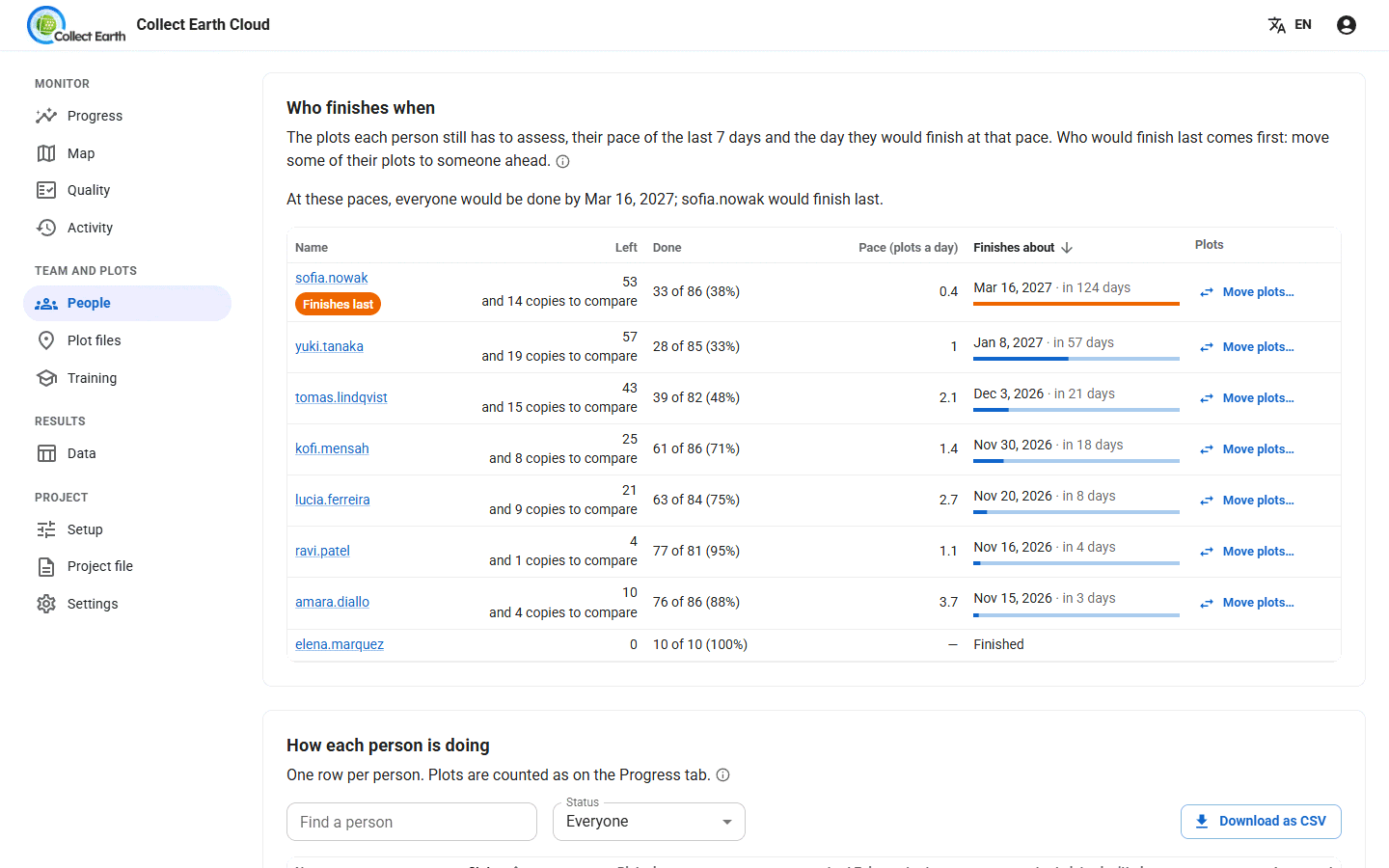
People shows how each person is doing: plots, speed, last sync and agreement, with a page per person. Only coordinators see the time spent on each plot; very quick plots are flagged. Who finishes when lists each person's plots left, their pace over the last 7 days and the day they would finish at that pace, the last to finish first, with Move plots… to give some of their plots to someone ahead.
Map shows every plot coloured by its status. Click a plot to open its page with every answer it received.
Activity lists what happened (plots submitted, files changed, people joined), and gives a weekly summary and downloads.
Checking the quality
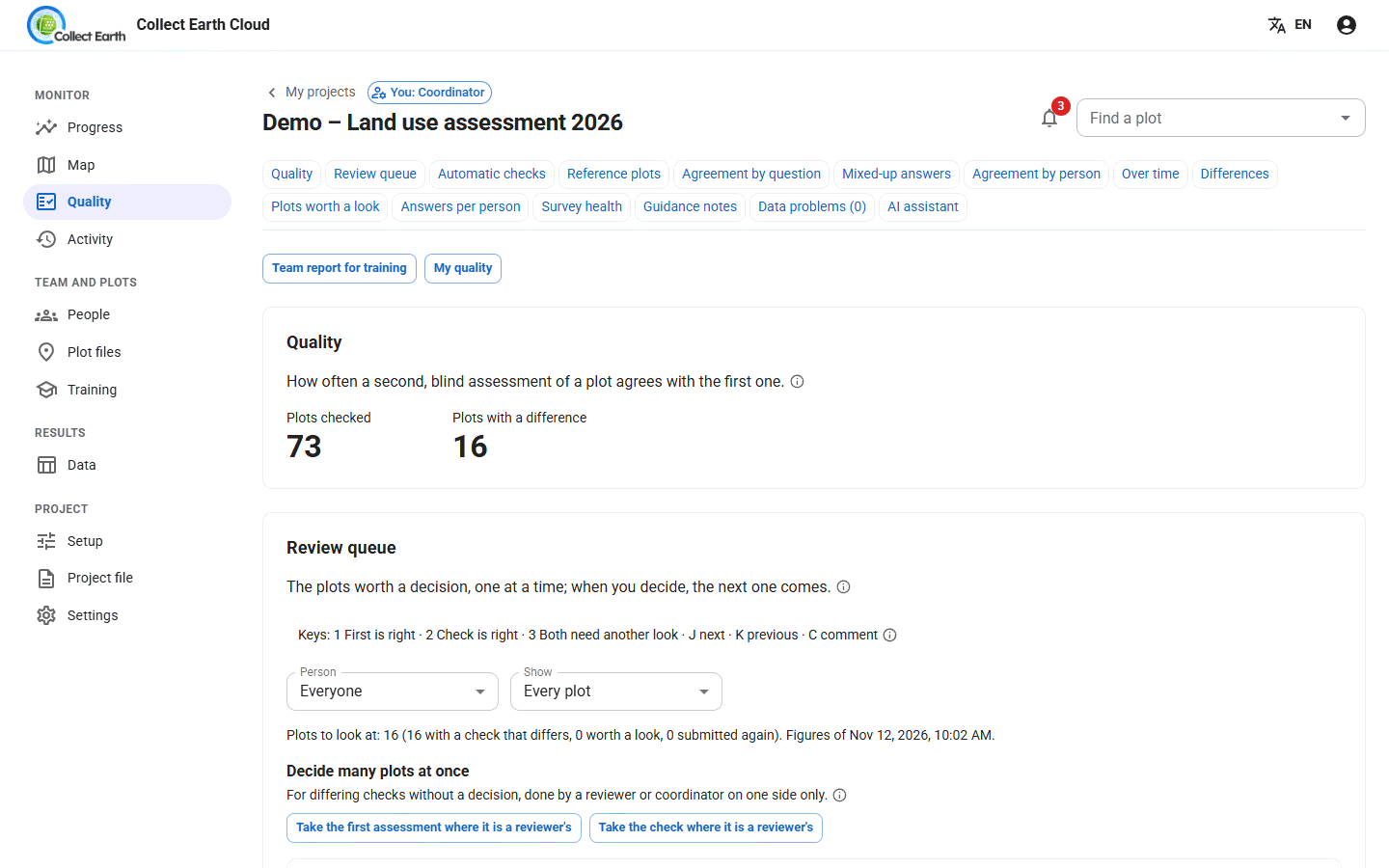
The Quality tab compares the answers of plots that two people assessed blind.
- Automatic checks: copy the first plots each person submits, or a share of all their plots, to chosen checkers as blind second assessments. Press Draw now to start at once.
- Review queue: for each plot where the answers differ, decide First is right, Check is right or Both need another look. Decide many plots at once speeds this up.
- Reference plots: plots an expert has assessed. Every collector also gets them blind, which measures each person's accuracy.
- Agreement by question, Agreement by person, Mixed-up answers and Over time show where the team disagrees.
- Plots worth a look lists plots done very fast, with the same answers as before, with required answers missing, or edited after a decision.
- Guidance notes share decisions with the team, so everyone answers the same way next time.
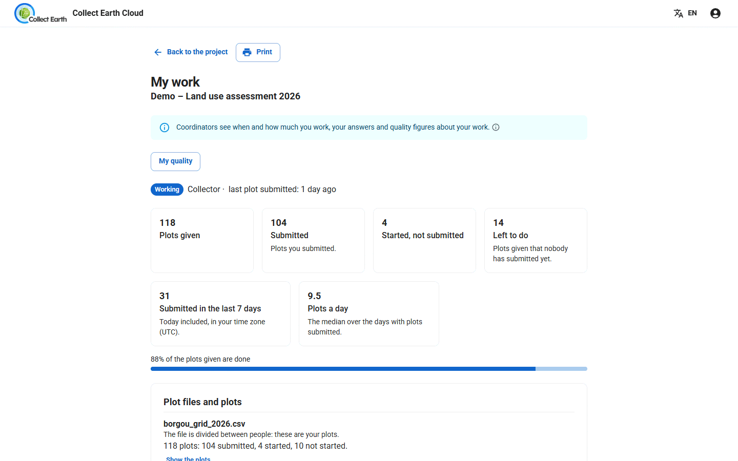
Collectors don't need the dashboard to work, but they can follow their own progress, quality and training on My work.
Reviewers can help with the review queue: their decisions are kept with their name, and their own plots go to someone else. They also see plots worth a look, the team's answers and the accuracy against reference plots, but no figures per person and no decisions on many plots at once.
Training the team
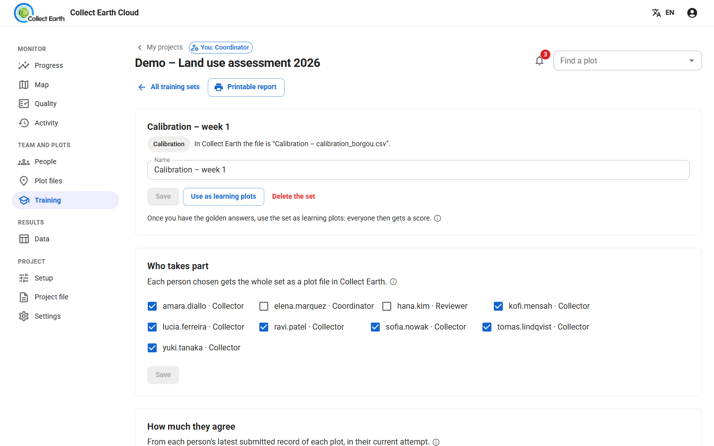
On Training, press Add a training set and choose the kind:
- Calibration: everyone assesses the same plots, to measure how much the team agrees before the real work starts.
- Learning plots: plots with a golden interpretation, so each person sees where they went wrong.
Each set has its own page with the golden interpretation, how much people agree, scores, plot by plot results and a printable report. Training plots are kept apart: they never count in progress, quality figures or downloads.
Getting the data out
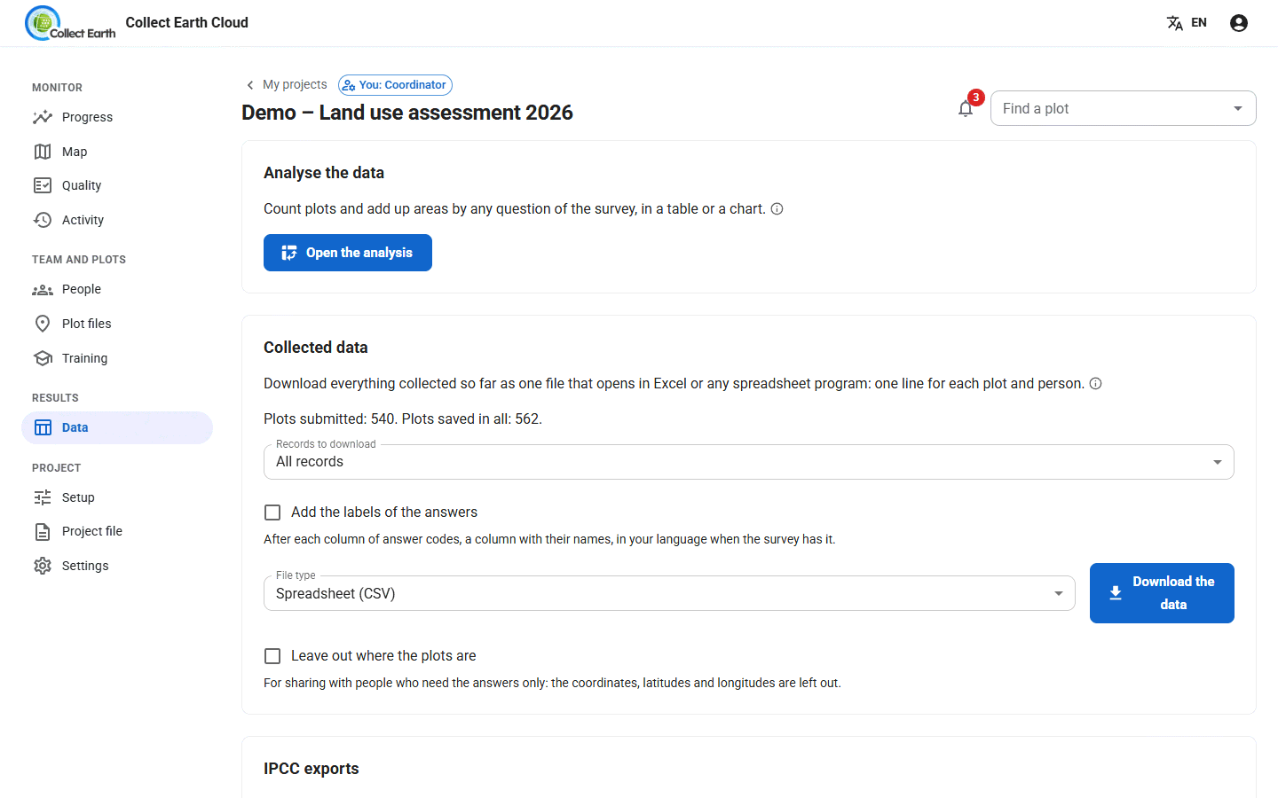
On the Data tab:
- Download the data: every answer, with the coordinator's final decision for each plot, as a Spreadsheet (CSV) or as a map file (GeoJSON, KML for Google Earth, or a zipped shapefile). Under Records to download, take all records, those changed since your last download or from a date, or those with a given answer. Tick Add the labels of the answers for a column with the names of the answers after each column of codes, in your language when the survey has it, and Leave out where the plots are to share it without coordinates. The spreadsheet follows your language's number format, and when the project has areas each plot comes with its expansion factor and weight.
- Open the analysis: tables and charts in the browser, a stand-alone file to share, and the Uncertainty (IPCC) of the land areas.
- IPCC exports: the files of Collect Earth's IPCC tool, from the plots' first assessments: land use change matrices (Excel, also by climate, soil and ecological zone), the land uses of each plot year by year, the land units, the land use changes as XML, and a file for the IPCC Inventory Software. Give the strata their areas first (Strata and areas).
- Collect Earth backup: the survey and all records in one file, first assessments only or every round: a zip that Collect Earth imports with Data Import/Export › Import data (ZIP or CSV), or an Open Foris Collect backup (
.collect-backup) that Collect restores. Either can also start a new project on another server. - Import data from Collect Earth: bring in plots assessed in a stand-alone Collect Earth (its compressed XML export), matching each person in the file to an account. Each person can also send their records from Collect Earth itself, with Data Import/Export › Send this computer's records to the cloud project.
Project settings
- Progress: a deadline, a target in plots, and after how many quiet days a person is flagged.
- Progress links for funders: a read-only progress page you can share without an account.
- AI assistant: an optional helper for reviews, if the server allows it.
- Project status: close a finished project, archive it, or reopen it.
- Copy this project, with or without its people and assignments, to start a similar one. The copy starts as a draft: Collect Earth can't send records to it until you press Make active under Project status.
If a laptop is lost or shared, open the person's page in People and press Sign out everywhere. A sign-in left unused for 90 days also ends by itself.
Bringing in a Collect Earth Online project
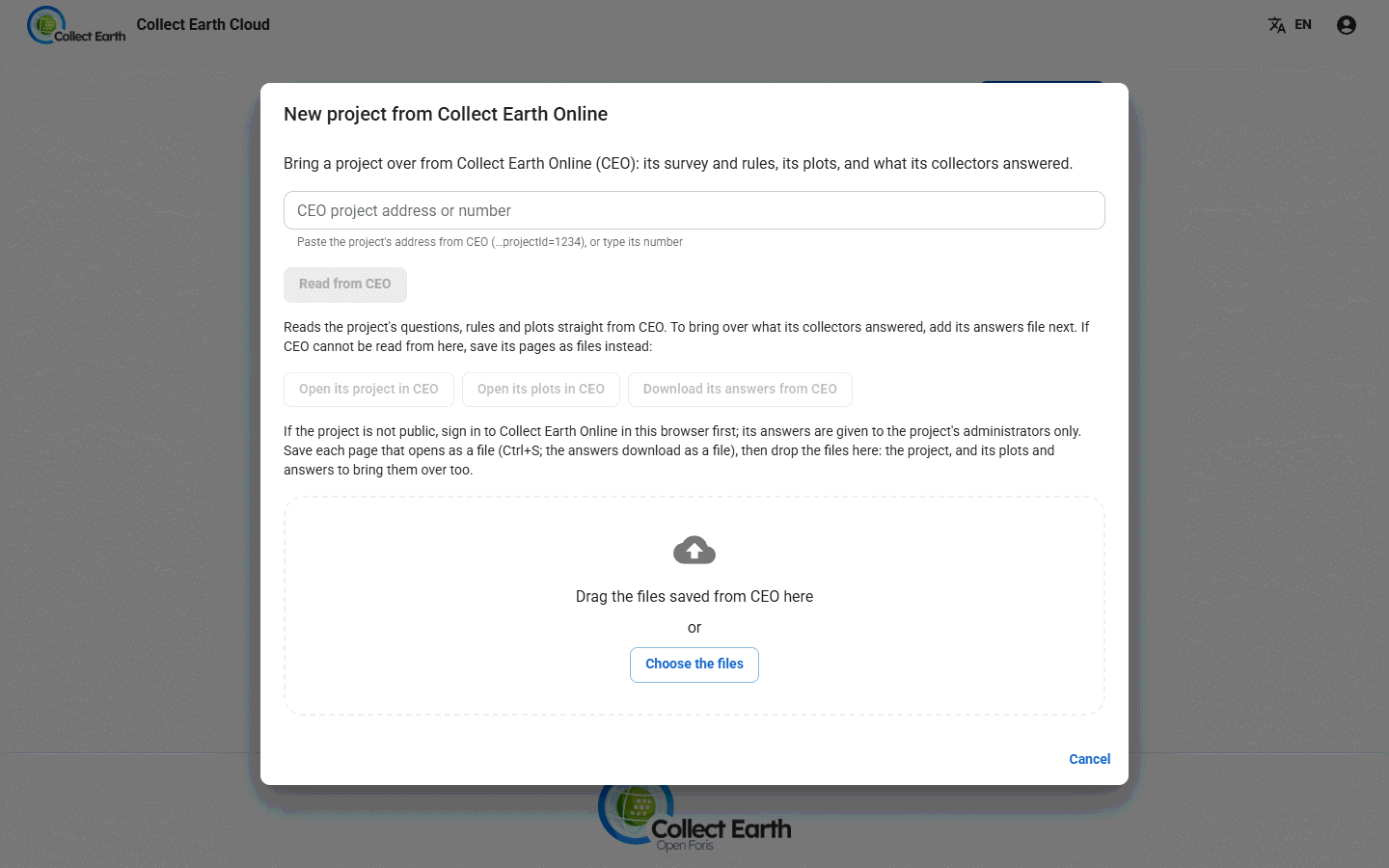
On My projects, press New project and choose From Collect Earth Online and paste the CEO project's address or number, then Read from CEO. The questions and plots of a public project come across directly; a CSV of answers already collected can be added too. Plot and sample shapes, such as FRA's hexagons, are copied in the background while you work.